Leaving Coober Pedy, there were thousands of piles of dirt along the road (brought up from nearby opal mine shafts). They were the only thing for hours, except for the occasional roadhouse.

This is the turnoff for Cadney Park, another roadhouse/town along the Stuart Highway. The roadhouse is the entire town. If you blink you could literally miss the entire place. We stopped for gas again--with the roadhouses hundreds of kilometers apart, we topped up our tank every chance that we got.


We love to spot new animal road signs, and this was the first cow crossing sign we passed.

We stopped at the South Australia/Northern Territory border to take a quick photo. We were photobombed by the little girl on the left, whose family we'd met previously and with whom we'd been leap-frogging campsites and roadhouses for hundreds of kilometers at this point. With only one road heading north-south through the Outback, we kept seeing the same families and cars over and over!

We made a pit stop in Kulgera, another roadhouse.


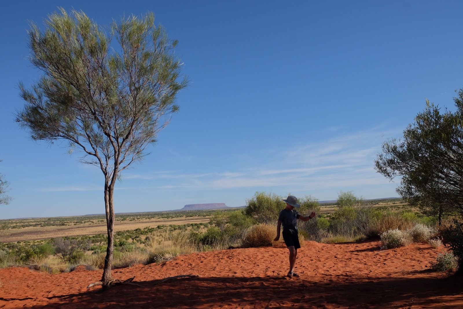
At Erldunda, we turned off Stuart Highway and headed west along Lasseter Highway, towards Uluru-Kata Tjuta National Park. We stopped at a lookout, thinking this big rock off in the distance was Uluru, and felt like completely clueless tourists when some Australians told us it was actually Mount Conner. Oops! We sat and chatted with them for 30 minutes about long term traveling (they were full-time RV'ers), Australian and US politics, and sights in the area.

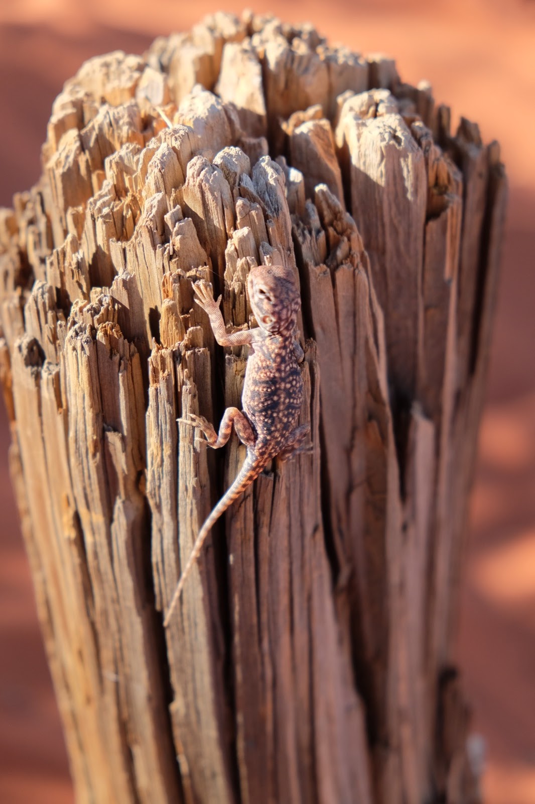
Across the road from the lookout, we climbed a small sand hill and found this guy.

And we looked out over another large salt lake.

The boys played in the red, red sand for a bit while Bob and I enjoyed the scenic views.


That evening we arrived at a campground in Yulara, the town outside Uluru. The next morning, we headed into the national park and quickly found another new animal crossing sign---for camels!

Uluru-Kata Tjuta National Park encompasses two natural wonders of the Australian Outback. The first, Uluru, was known as Ayers Rock until 1993, when it was renamed with its traditional Aboriginal name. This massive sandstone rock formation towers above the surrounding land, and it is a formation of great spiritual and cultural importance to the Pitjantjatjara Anangu, the Aboriginal people of the area.

While it is still technically possible to climb to the top of Uluru, the traditional owners have asked that people respect its spiritual and cultural significance and refrain from climbing. It's an interesting setup in which climbing the rock is not banned because the Aboriginal people hope that visitors will respect their wishes and make the choice not to climb on their own, rather than being prohibited outright. This request is communicated in signs throughout the park, and on all park literature (tickets, brochures, etc.). We saw a surprising number of people climbing the rock, but we chose to respect the Aboriginal people's wishes and instead completed the Uluru Base Walk, a 10 km (6.2 mile) flat walk around the rock itself.

The walk took us past a number of areas of the rock with interesting features and significance to the Aboriginal people.

There are so many flies in the Australian Outback! The fly nets that I'd picked up at the grocery store quickly came out as we tired of flies getting in our eyes, ears, noses, and mouths.


We found a small water pool where water runs off Uluru when it rains.

It was a hot walk! Even though we visited in what is technically the fall season, it was still about 32 C (90 F) on this day. "Not hot" as the locals told us, but without a lot of shade it was still a bit trying in some spots. We took advantage of shaded rest areas and drinking water taps to stay cool(er) and hydrated.

Around the rock there were plaques with the traditional stories of how these features came about. These stories related to morals and laws that were important to the tribe, such as ideas of sharing resources and respecting the hunts of others.


There was a cave with some Aboriginal paintings, too.


We finished up the base walk in the afternoon and after lunch made our way to a community festival in Yulara. When we arrived, we learned that the festival organizers were a group comprised of students from all over Australia. They'd traveled from their homes, meeting and staying with Aboriginal communities along the way, until they all converged at Uluru for the last part of their trip. The goal of the program is to promote contact and understanding between indigenous and non-indigenous Australians, as there is still a lot of misperception, division, and racism that exists to this day.
The festival was the culmination of the group's time at Uluru, and there were a lot of members of the local indigenous tribes who came to participate. We only saw a handful of other tourists, such as ourselves, but the group welcomed us and the kids had a great time playing and participating in all kinds of activities.


The absolute highlight of the festival for all the kids was a giant slip and slide that was set up. One of the organizers told us that this is the one day of the year that the local kids get to play with/in water. It is such a scarce resource in their communities that it is never wasted on water play.


We left the festival in time to return to Uluru to watch the sun set.

The way that the colors of the rock changed as the sun went down was just incredible. It didn't look like it was going to be anything spectacular until, all of a sudden, it was as if the rock was lit up from inside and the colors just popped out of nowhere.


The changing colors of the sky as the sun finally set were also incredible.


The next morning, we packed up our camper (again). We sent the boys off to get ice and they eventually made it back, carrying the bag between them.

We headed back into the park but, this time, to the Kata Tjuta part. Kata Tjuta used to be known as The Olgas until it was also renamed in respect for its traditional owners. There are 36 rock domes that are also an area of spiritual and cultural significance for the local Aboriginal people.
We hiked the full Valley of the Winds walk, which was 7.4 km (4.6 miles). It was not flat, like the base walk at Uluru, but instead took us over, through, and around some of Kata Tjuta's beautiful formations.


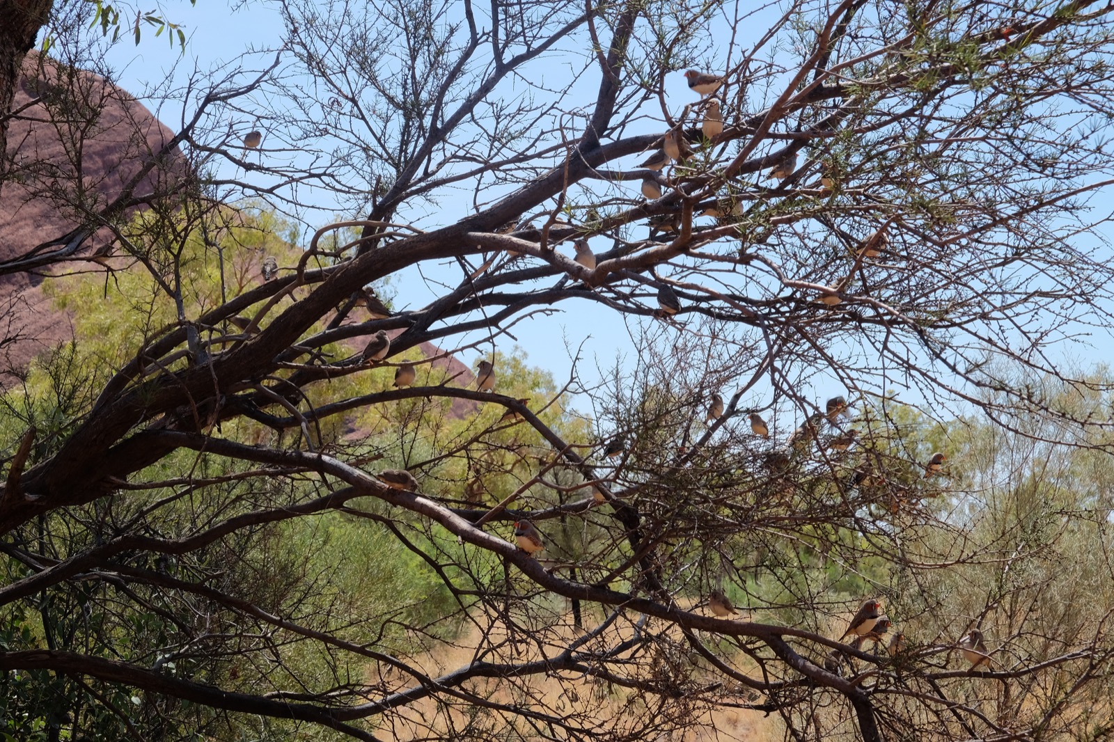
At one of the shaded rest areas, the boys carefully observed a tiny bird that was hopping about.

We saw lots of other birds in the trees.
And we saw this big lizard guy catching some shade underneath a bush!

Hiking through Kata Tjuta was more interesting than hiking around Uluru, in our opinion. The terrain was more varied and interesting, and we really enjoyed hiking over and through the rock formations, rather than just around the perimeter.
We left Kata Tjuta in the afternoon and drove a couple of hours until we were just outside King's Canyon. Until this point we'd stayed at campsites both out of choice and convenience, but with a fully contained camper we were eager to do some freestyle camping, too. Camping just anywhere is not allowed in Australia, but thanks to a fantastic Wikicamps app, we were easily able to locate places that we could spend the night legally. We pulled into one such spot that provided a fantastic overview of the surrounding area.


As the sun set, I prepared a simple camp dinner that we enjoyed while watching the sun continue to set.


Eventually we could see the moon coming out.

And we went to sleep under the clear Outback sky!

Truly amazing!
ReplyDelete